Watch a livestream of our coverage in player above.
Latest alerts | Submit your weather photos and videos | Download our apps
LUBBOCK, Texas (KCBD) – update 8:36 p.m. – The tornado warning has been allowed to expire for Lubbock. A severe thunderstorm warning is in place.
Very large hail fell across south Lubbock, while the rotating part of the storm moved over central parts of the city. We haven’t had reports of the tornado on the ground since it was reported near Reese Center west of Lubbock last hour.
update 7:26 p.m. – A tornado was reported near Reese Center. It is moving east around 10-15mph. Everyone in W/NW Lubbock County needs to be in shelter now.
New tornado warning has been issued, including Lubbock County and parts of the City of Lubbock.
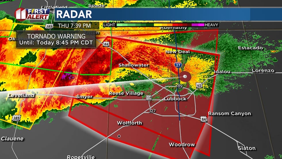
update 6:56 p.m. – The National Weather Service has issued a tornado warning for Lubbock County including the City of Lubbock.
update 6:28 p.m. – New tornado warning now for Hockley County. Rotation isn’t as tight as a few minutes ago, but this remains a serious storm.
This storm has a history of producing large tornadoes and hail to the size of softballs. Storm is moving east at 35mph.
update 5:48 p.m. – A confirmed tornado is passing just north of Morton, moving ESE at 20mph.
update 5:24 p.m. – A storm has produced a tornado at multiple times over the last half hour, from Roosevelt County, NM now into NW Cochran County. The storm is moving east at 20mph.
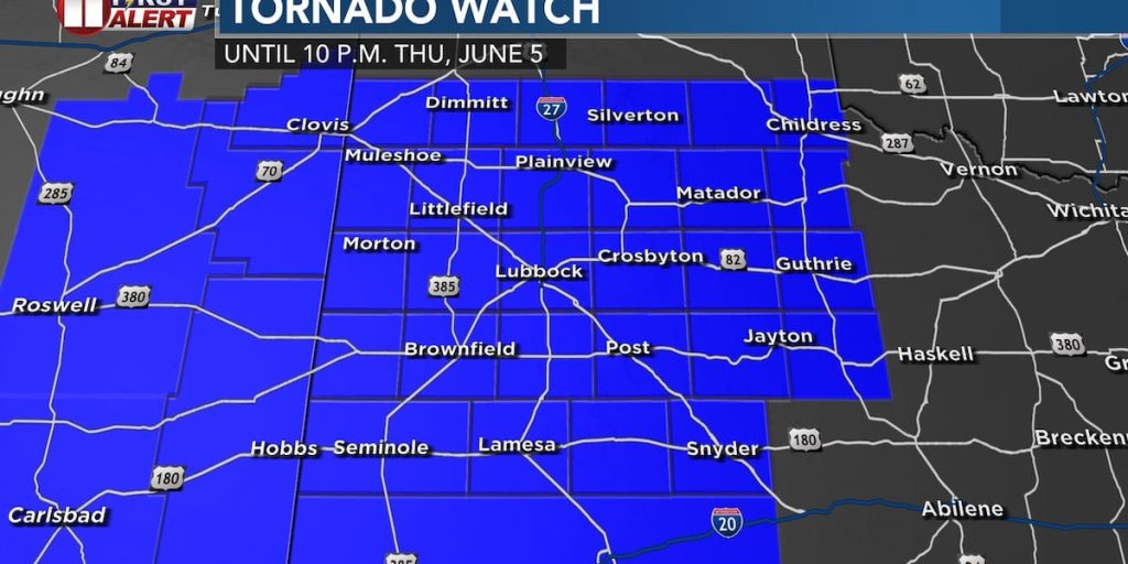
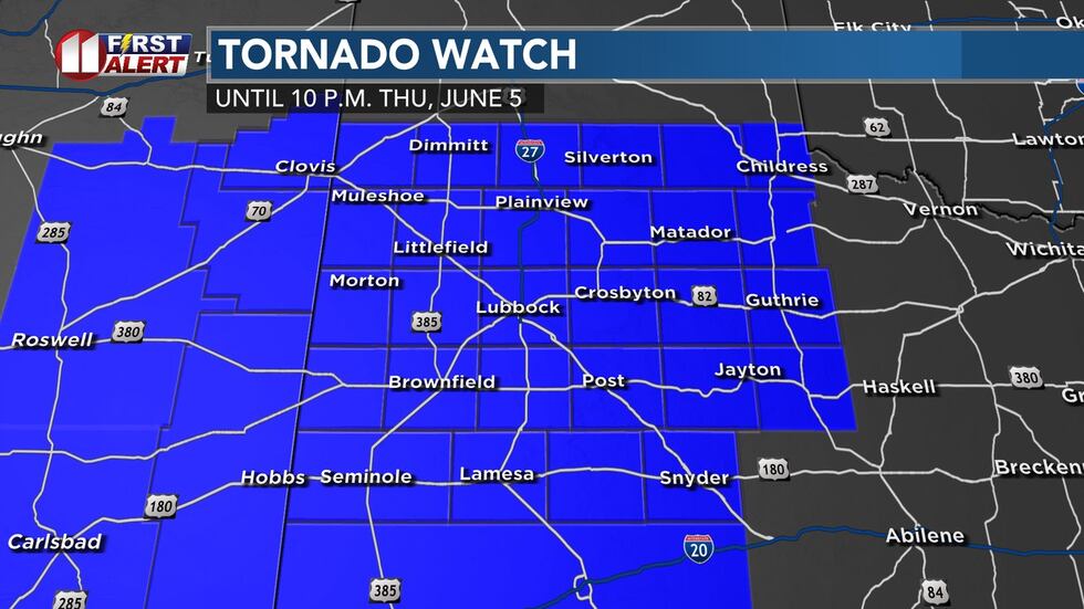
The Storm Prediction Center has issued a tornado watch for Lubbock, the South Plains and Rolling Plains, part of the Permian Basin, and Eastern New Mexico, in effect until 10 p.m. CT, shown in blue.
The watch means there is the potential for severe weather. Warnings are issued when severe weather is occurring.
The Storm Prediction Center text states primary risks are: a few tornadoes likely, with a couple intense tornadoes possible; scattered large hail and isolated very large hail to 4 inches diameter; scattered damaging wind with isolated significant gusts to 80mph.
TIMING
Storms will develop through mid-afternoon, first over the western South Plains and/or Eastern New Mexico. Then they will spread eastward late afternoon into the evening. As of 1:45, it is much warmer over the SW South Plains, where the sky has cleared. Temp is in the mid 80s. We expect additional clearing through the afternoon across the area.
It’s very humid, with dew points in the mid 60s to lower 70s. This is leading to a lot of surface energy. There is also a lot of shear, or twisting in the wind, to promote rotating storms. Storms that move near an outflow boundary will have a greater likelihood to rotate.
Storms should push farther east, over the Rolling Plains, into this evening.
NEXT FEW DAYS
Another round of severe weather is expected tomorrow afternoon and evening, prompting another First Alert Weather Day. The pattern will stay fairly active, with more severe storms possible this afternoon into next week.
Copyright 2025 KCBD. All rights reserved.